Background
The U.S. Fish and Wildlife Service's Office of Conservation Investment manages over a billion dollars in grants to recipients across the U.S. annually for species and habitat conservation, recreation, and outdoor education. The standards for program accountability are high, both in terms of the legal requirements set in statute and regulation for grant recipients and grant managers, as well as the expectations of Congress, the tax-paying outdoor industry, and the public.
The North American Model of Conservation has been called “The Greatest Story Never Told.” By implementing a standardized reporting structure and metrics, the Office of Conservation Investment can easily communicate program accomplishments by rolling-up data to report on the partnerships performance at various scales. At the same time, the Office of Conservation Investment can demonstrate that recipients are meeting Federal Grant reporting requirements and bring efficiencies to performance reporting by using new technologies.
What is Wildlife TRACS?
Wildlife TRACS, which stands for Tracking and Reporting Actions for the Conservation of Species, is the performance reporting tool used by the U.S. Fish & Wildlife Service (USFWS) Office of Conservation Investment to capture conservation and related actions funded by its grant programs: including Wildlife Restoration, Hunter Education, Sport Fish Restoration, Aquatic Education, Boating Access, Clean Vessel Act, Boating Infrastructure, National Coastal Wetlands Conservation, and State Wildlife Grants.
The TRACS application (https://tracs.fws.gov/login) provides a standardized grant reporting tool that meets or exceeds federal regulations. Note: TRACS also has a Training Environment, a copy of the live system that is used for training and practice purposes only.
Note that TRACS is not a grant application or management system. Formal grant approval occurs in Grant Solutions (GS), not TRACS. GrantSolutions (GS) is the Federal financial assistance management system used by applicants, federal staff, and award recipients to perform and monitor the status of their respective financial assistance management activities throughout the lifecycle of the award.
Who uses TRACS?
The TRACS application is used by Non-federal grant recipients and Federal grant managers to create, manage, review, and approve grant proposals and performance reports, in order to document the progress and completion of grant objectives. TRACS also provides an electronic repository for grant-funded Facility and Real Property (lands) records. In addition, TRACS also serves as the electronic system for license certification and apportionments.
Why TRACS?
TRACS helps to highlight program accountability by making it easier to demonstrate performance. It will allow us to demonstrate accountability and transparency to our industry partners and elected officials.
Enhances Accountability by:
- Meeting Federal reporting requirements
- Demonstrating sound grant management
Providing transparency on use of excise tax dollars
Improves Efficiency by:
- Streamlining data entry and reducing redundancy
- Using modern, user friendly web technology
- Simplifying performance reporting and response to data calls
Enables Effectiveness by:
- Generating accurate, nationally consistent reports at various scales
- Allowing projects to be viewed spatially (GIS)
- Supporting efforts to tell the “Story”
What is the TRACS Enhancement?
A redesigned TRACS system launched in mid-2020 was developed by the Program Accomplishment Reporting (PAR) Branch under the collaborative direction of the Meeting of the Parties, Joint Task Force (JTF), and TRACS Working Group.
TRACS is a software tool designed to simplify the task of reporting on grant performance. To be effective, software tools like TRACS need to be easy to use, intuitive and logical to navigate, and designed with the user in mind. The TRACS Enhancement was necessary to enhance the systems performance and to improve the experience for TRACS users.
The original version of TRACS was taken offline October 2018 to kickoff the development phase for the TRACS Enhancement. The enhancement has been developed by the Program Accomplishment Reporting (PAR) Branch under the collaborative direction of the Meeting of the Parties, Joint Task Force (JTF), and TRACS Working Group.
The TRACS Working Group, comprised of 29 State and Federal system users, spent thousands of hours and solicited thousands of comments to simplify and standardize data fields and to improve the look and feel of the system from the user perspective.
The Working Group participated in six waves of initial (Alpha) testing and developed the data fields (requirements matrixes) and the system workflow and navigation (wireframes), which went out for multiple rounds of national comment for review by all 50 states and 6 territories, with thousands of comments collected and addressed to improve the system workflow.
The TRACS Version 2 Enhancement was released in June 2020, in accordance with the TRACS Memorandum of Understanding (MOU) signed by the Association of Fish and Wildlife Agencies (AFWA) President and the U.S. Fish and Wildlife Service Director.
What does TRACS do?
TRACS has been designed to:
- Document grant performance
- Standardize accomplishment reporting
- Allow projects to be viewed spatially with Geographic Information System (GIS) software
- Present Program accomplishments on a national scale
- Certify hunting and fishing licenses and generate apportionments
- Maintain and reconcile Real Property (Lands) and Facility Inventory Records
All of the activities funded by grants are organized by 14 standardized Strategies listed below:
- Coordination and Administration
- Direct Habitat and Species Management
- Environmental Review
- Facilities and Areas Construction, Renovation or Acquisition
- Facilities and Areas O&M
- Incentives
- Outreach and Communications
- Planning
- Real Property Acquisition
- Research, Survey, Data Collection and Analysis
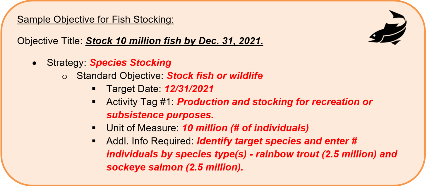
- Species Stocking
- Stakeholder Involvement
- Technical Assistance
- Training and Education
Within each strategy are Standard Objectives, which include a unit of measure, a target date and one or more activity tags that further define the objective. For some activities, the system asks for the target species or target habitat type(s), real property or facilities information. TRACS displays the location of the activity on a map, such as “statewide” or a more specific location if entered. Each strategy has a “Strategy Fact Sheet” that describes those requirements, see example below.